Mount Tempest Hike Guide: The World's Highest Coastal Sand Dune
Mount Tempest holds a genuinely rare title: the highest coastal sand dune on Earth, at 285 metres above a beach with no rock underneath it at all, just wind-piled sand held together by root systems built over tens of thousands of years. The hike is short. Reaching the trailhead is the part most people underestimate.
Trip planning note: prices, permits, timetables and historical ratings below are estimates or background examples, not current booking quotes. Use the provider calendar for the selected departure and confirm all mandatory fees.
No verified affiliate itinerary found in the reviewed products includes this summit. The booking choices below are alternative island activities, not access to the hike. Explore Kayak, Snorkel And Sandboard
Moreton Island is built almost entirely from sand blown and piled over tens of thousands of years, and Mount Tempest is the proof of how high that process can go. At 285 metres, it holds the title of the world's highest coastal sand dune, a genuinely unusual landform rather than a hill in the conventional sense.
Mount Tempest: the numbers
Figures reflect published elevation and track-length data for Mount Tempest, Moreton Island.
The Quick Answer
Mount Tempest is a 285-metre vegetated sand dune, the highest coastal sand dune in the world, reached by a roughly 2.5 kilometre return walking track through forest to the summit. The hike itself is moderate, but getting to the trailhead requires a 4WD and a vehicle permit, since it sits well inland from any sealed or maintained road.
No verified product reviewed promises the Mount Tempest summit hike. Use the independent walking and trailhead plan above.
Why Is Mount Tempest Famous?
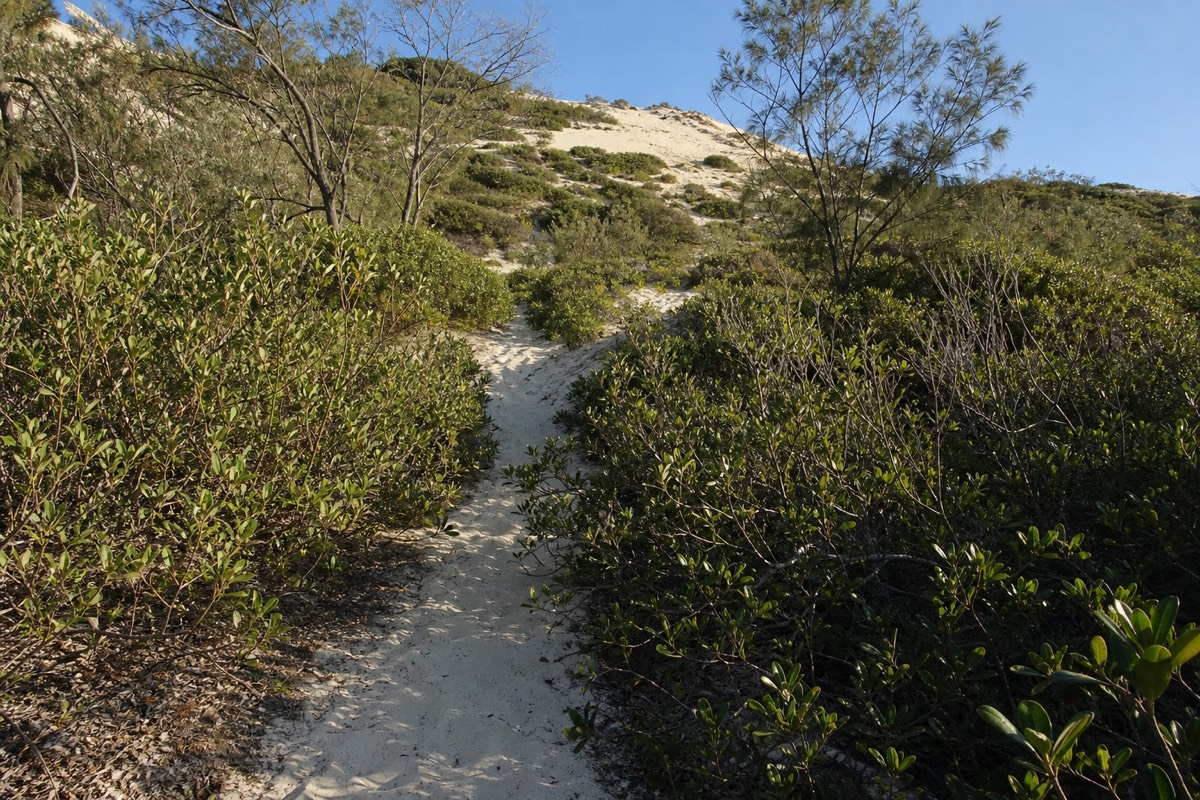
At 285 metres above sea level, Mount Tempest is recognised as the highest coastal sand dune in the world, built entirely from wind-blown sand rather than rock, and stabilised over an immense span of time by vegetation growing through it. That's a genuinely rare landform. Most of the world's tallest dunes sit in deserts far from the coast; Mount Tempest rises directly from a Queensland beach.
No verified product reviewed promises the Mount Tempest summit hike. Use the independent walking and trailhead plan above.
How Long And How Hard Is The Hike?
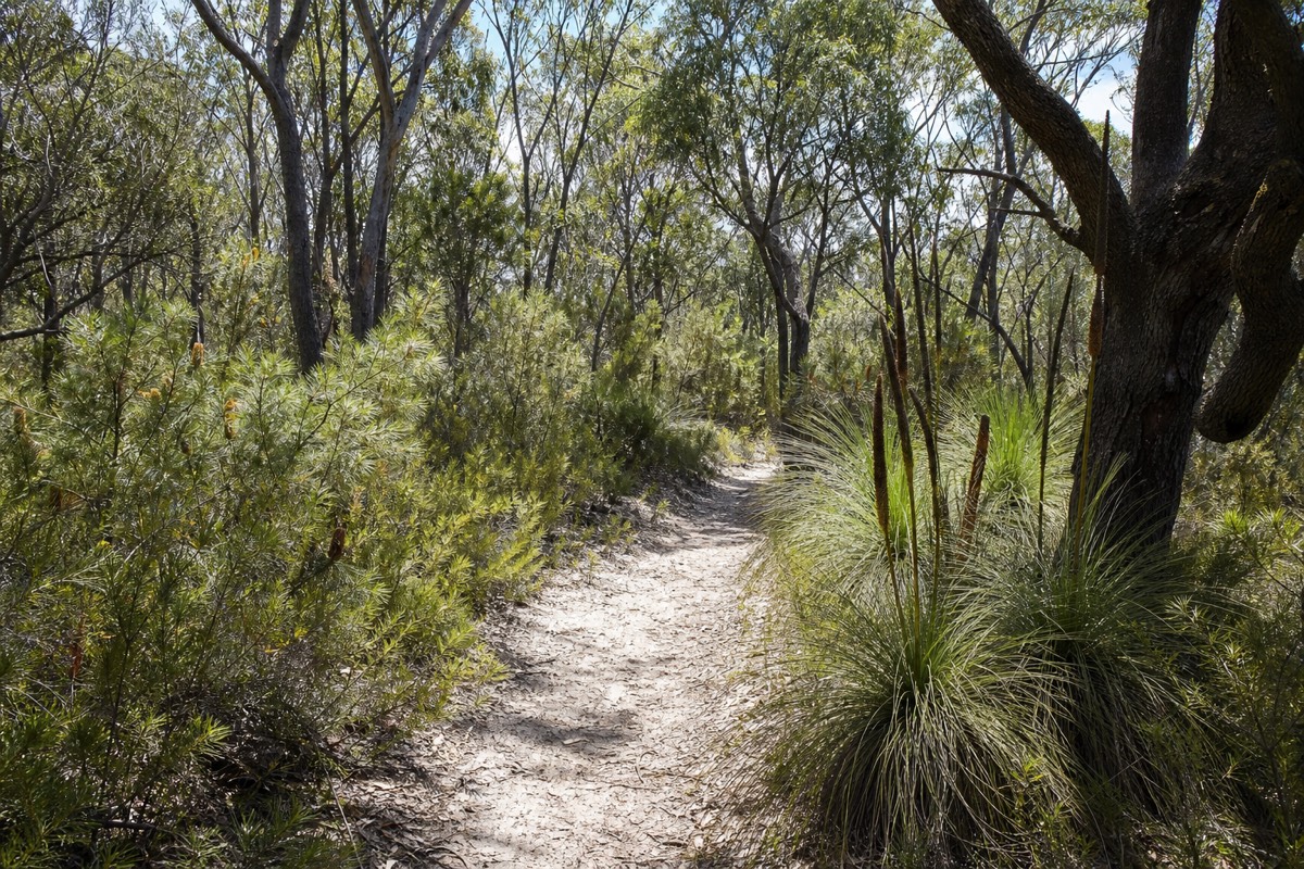
The walking track is around 2.5 kilometres return, climbing steadily through vegetated dune forest to the summit; it's a moderate hike, more about sustained climbing than technical difficulty, and takes most walkers a little over an hour round trip at an easy pace.
| Detail | What to expect |
|---|---|
| Track length | ~2.5km return |
| Elevation gain | Steady climb to 285m summit |
| Surface | Sandy forest track |
| Difficulty | Moderate; sustained climb rather than technical |
| Time | Roughly 1-1.5 hours return at an easy pace |
No verified product reviewed promises the Mount Tempest summit hike. Use the independent walking and trailhead plan above.
How Do You Get To The Trailhead?
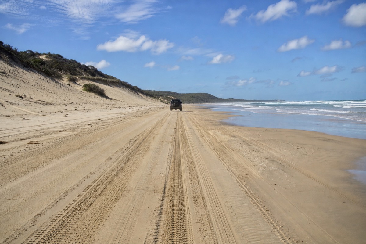
The trailhead sits well inland from Moreton Island's coastal tracks and is only reachable by 4WD, with a vehicle access permit required, so this is not a walk-up-from-the-beach hike. Most independent visitors reach it as part of a longer 4WD day combining the interior tracks with a coastal stop; see our 4WD guide for permit cost and route detail.
No verified product reviewed promises the Mount Tempest summit hike. Use the independent walking and trailhead plan above.
What Does The View Actually Look Like From The Top?
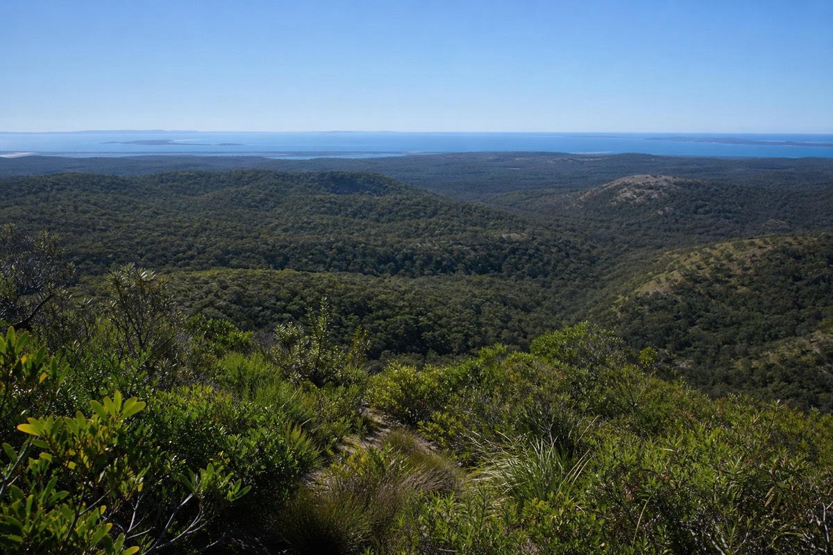
From the summit, expect sweeping views over the forested dune landscape of the island's interior and out toward Moreton Bay, a genuinely wide panorama for a walk this short. Because Mount Tempest sits roughly central on the island, the view differs from the ocean-horizon panorama at Cape Moreton; here you're looking down over the island's own dune country rather than out to open sea.
No verified product reviewed promises the Mount Tempest summit hike. Use the independent walking and trailhead plan above.
What Should You Bring?
- Sturdy closed shoes; sand tracks are harder work than they look and loose underfoot
- Water, since there's no supply at the trailhead or summit
- Sun protection, particularly if you're hiking around the middle of the day
- A 4WD and current vehicle permit to reach the trailhead at all
No verified product reviewed promises the Mount Tempest summit hike. Use the independent walking and trailhead plan above.
Best Time Of Day And Year To Hike
Early morning is the most comfortable time to climb, avoiding the heat of the day, and the cooler months from roughly April to October make the sandy climb noticeably easier than a summer afternoon. See our best time to visit guide for the full seasonal picture.
No verified product reviewed promises the Mount Tempest summit hike. Use the independent walking and trailhead plan above.
How Does A Sand Dune Actually Get This Tall?
Mount Tempest built up over an immense span of geological time as wind carried sand inland from the beach and piled it against itself, with vegetation slowly taking root and stabilising each layer before the next was deposited on top, a process that only works where wind, sand supply and plant colonisation all line up over a very long period. That's why coastal dunes this tall are so rare globally: most either lack the sand supply, the wind pattern, or enough time before erosion or development interrupts the build-up.
No verified product reviewed promises the Mount Tempest summit hike. Use the independent walking and trailhead plan above.
What Does The Vegetation On The Way Up Actually Look Like?
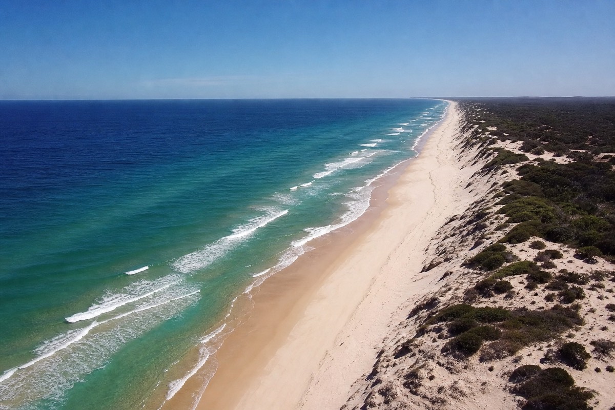
The track climbs through genuine forest rather than open sand for most of its length, banksia, eucalypt woodland and low heath rooting into the stabilised dune, which is part of what makes the climb feel more like a bushwalk than a desert trek despite the sand underfoot. Only near the exposed summit does the vegetation thin enough to open up the full panoramic view the hike is known for.
No verified product reviewed promises the Mount Tempest summit hike. Use the independent walking and trailhead plan above.
Mount Tempest Vs The Interior Sandboarding Dunes: What's The Difference?
Mount Tempest is a vegetated, forested dune reached by a walking track, built for a hike and a view; the sandboarding dunes in the island's bare interior "Desert" are unvegetated and built for speed, not scenery. They sit in different parts of the island's interior and serve entirely different purposes on a visit, though both are worth combining on a longer 4WD day.
| Mount Tempest | Sandboarding dunes | |
|---|---|---|
| Vegetation | Forested, stabilised | Bare, unvegetated |
| Purpose | Hiking, the view | Sandboarding speed and thrill |
| Access | Walking track from a 4WD trailhead | Drive directly to the dune face |
| Typical time needed | 1-1.5 hours | 30-60 minutes |
What Should A Fitness-Realistic Hiker Expect?
The climb is sustained rather than technical: no scrambling or exposure, but a steady uphill grade on sand for the majority of the 1.25km one-way distance, which is noticeably more tiring than the same distance on a firm bushwalking track. Anyone reasonably fit and used to moderate walks should manage it comfortably; anyone with knee or hip issues that make uneven, soft-underfoot walking difficult should treat this as a harder outing than the distance alone suggests. If a shorter, flatter walk sounds more appealing, the coastal trails around North Point and Honeymoon Bay are a gentler alternative.
No verified product reviewed promises the Mount Tempest summit hike. Use the independent walking and trailhead plan above.
How Does Mount Tempest Compare To Other Famous Dunes Around The World?
Most of the world's tallest sand dunes sit in inland deserts, built up over vast, dry landmasses far from any coast; a coastal dune reaching 285 metres is a genuinely different and rarer phenomenon, since coastal sand supply, vegetation and wind patterns rarely align this favourably anywhere else on Earth. That's the real basis for the "highest coastal sand dune" title: not that Mount Tempest is the tallest dune anywhere, but that it's the tallest one built directly by ocean-driven sand supply rather than desert wind systems.
No verified product reviewed promises the Mount Tempest summit hike. Use the independent walking and trailhead plan above.
Does A Standard Full-Day Tour Include The Mount Tempest Summit Hike?
Usually not. Standard full-day Moreton Island tours pack in the wrecks, sandboarding and beach time already, and the round trip to Mount Tempest's trailhead plus the hike itself adds a genuine extra hour or more that most fixed itineraries don't have room for. The hike is realistically a self-drive, private-charter or camping-trip addition rather than something to expect on a standard group day tour, so if summiting Mount Tempest is a priority, say so when booking, or plan to reach it independently.
| Trip type | Mount Tempest realistically included? |
|---|---|
| Standard full-day group tour | Not typically; itinerary is usually full elsewhere |
| Private or custom-charter tour | Possible if requested in advance |
| Self-drive 4WD day | Yes, achievable as one stop on a longer route |
| Camping trip (2+ nights) | Yes, comfortably fits on a middle day with no ferry deadline |
No verified product reviewed promises the Mount Tempest summit hike. Use the independent walking and trailhead plan above.
What Does It Cost To Visit Mount Tempest Independently?
Beyond the ferry, the only extra cost is the same vehicle access permit every self-driving visitor to Moreton Island needs, typically around $50-70, since the hike itself has no separate entry fee. The real cost of visiting independently is less about money and more about the half-day of driving and 4WD experience it takes to reach the inland trailhead at all.
| Cost item | Typical figure |
|---|---|
| Vehicle access permit | ~$50-70, see our 4WD guide |
| Hiking track fee | None |
| 4WD hire (if needed) | ~$150-300/day plus fuel |
| Ferry (vehicle) | ~$80-120 return |
No verified product reviewed promises the Mount Tempest summit hike. Use the independent walking and trailhead plan above.
How Does The Hike Change Through The Year?
The climb itself doesn't change, but the comfort of doing it does: cooler months make the sandy uphill grade noticeably easier, while a summer midday attempt turns a moderate walk into a genuinely hot, draining one. See our best time to visit guide for the island-wide seasonal picture this fits into.
| Season | Hiking comfort |
|---|---|
| Summer (Dec-Feb) | Hot and humid; early morning only, extra water essential |
| Autumn (Mar-May) | Cooling, generally comfortable by mid-morning |
| Winter (Jun-Aug) | Coolest and most comfortable window for the climb |
| Spring (Sep-Nov) | Warming again; still manageable outside the midday heat |
No verified product reviewed promises the Mount Tempest summit hike. Use the independent walking and trailhead plan above.
Who Should Skip The Mount Tempest Hike?
Anyone with a heart or respiratory condition affected by sustained uphill exertion in heat, anyone without sturdy closed footwear, and anyone attempting it in the middle of a summer afternoon without a genuine water reserve should reconsider or reschedule. None of this is exotic risk, it's the same caution that applies to any moderate, shadeless sand climb, but the "just a walk" framing in some trip photos undersells how much the loose sand underfoot adds to the effort compared with a firm bushwalking track of the same distance.
No verified product reviewed promises the Mount Tempest summit hike. Use the independent walking and trailhead plan above.
Common Mistakes First-Time Hikers Make Here
The three that come up most: underestimating water needs because the track "looks short" on paper, attempting the climb in thongs or open sandals that slide on loose sand, and arriving at the trailhead without checking that a permit and a genuine 4WD, not a soft-roader, are both required just to get there. A quieter fourth mistake is timing: starting the climb in the middle of a hot afternoon rather than early morning, when the sand track holds the day's heat and offers no shade at all until the vegetated upper section.
No verified product reviewed promises the Mount Tempest summit hike. Use the independent walking and trailhead plan above.
Does Mount Tempest Fit Naturally Into A Camping Trip?
Yes, more naturally than into a single day trip: campers with a middle day and no return ferry to catch can reach the inland trailhead, climb, and still have time for other interior landmarks the same day, exactly the kind of unhurried itinerary our camping guide describes for a typical two-to-three-night stay. Day-trippers on a fixed ferry schedule face a tighter trade-off, since the drive to the trailhead and the hike itself both eat into a day that's already carrying the wrecks, sandboarding and beach time.
No verified product reviewed promises the Mount Tempest summit hike. Use the independent walking and trailhead plan above.
How Much Does The View Change With The Weather And Time Of Year?
On a genuinely clear day the summit delivers a wide, sharp panorama over the forested dune interior and out to Moreton Bay; on a hazier or more humid day, especially in the wetter summer months, that same view can soften noticeably, with the bay horizon losing definition even though the climb itself is unaffected. This is a reasonable extra point in favour of a winter or shoulder-season visit beyond just hiking comfort: the drier air in the cooler months tends to give a crisper, further-reaching view than a humid summer afternoon.
No verified product reviewed promises the Mount Tempest summit hike. Use the independent walking and trailhead plan above.
Frequently Asked Practical Questions
- Is the track suitable for young children? Older, fit children generally manage it fine with breaks; the sustained sandy climb is genuinely tiring for very young hikers.
- Is there shade along the track? Most of the climb passes through vegetated dune forest, with the exposed summit being the main shadeless section.
- Can you drive all the way to the summit? No, the summit is reached on foot only; vehicles stop at the trailhead.
- Is the track well marked? Yes, it's a defined walking track rather than an off-track scramble, though loose sand still makes footing more effortful than the marked distance alone suggests.
No verified product reviewed promises the Mount Tempest summit hike. Use the independent walking and trailhead plan above.
What's The Single Biggest Thing First-Timers Underestimate About This Hike?
Almost universally, it's the sand underfoot rather than the distance or the elevation: 2.5 kilometres return sounds trivial on paper, and 285 metres of elevation gain sounds modest next to a mountain hike, but loose sand demands noticeably more effort per step than a firm track, which is why a walk that looks short on a map takes longer and feels harder than the numbers alone suggest. Anyone comparing this to a similar-distance hike on solid ground should mentally add a genuine difficulty step, not treat the stated distance as the whole story.
No verified product reviewed promises the Mount Tempest summit hike. Use the independent walking and trailhead plan above.
How Does The Effort Compare To What You Get At The Summit?
Weighed honestly, roughly an hour of sandy uphill walking for a genuinely rare natural record and a wide panoramic view is a strong trade by most hiking standards, closer to the effort-to-reward ratio of a well-regarded lookout walk than a serious mountain summit. It's demanding enough to feel earned, short enough to fit into a longer island day, and rare enough as a landform that the "highest coastal sand dune in the world" claim isn't just marketing language, it's the specific reason this modest-sounding walk draws hikers who've done far bigger climbs elsewhere.
No verified product reviewed promises the Mount Tempest summit hike. Use the independent walking and trailhead plan above.
What Would Make Someone Specifically Travel To Moreton Island Just For This Hike?
Dedicated dune and landform enthusiasts, hikers chasing a genuine "highest in the world" record, and photographers wanting a wide interior panorama unlike anything else on the island's coastline are the travellers most likely to prioritise Mount Tempest as a primary reason for visiting, rather than a stop that happens to fit into a broader day. For nearly everyone else, it remains a strong add-on to an existing 4WD or camping trip rather than a standalone destination worth planning an entire visit around, and that's a perfectly reasonable way to experience it too.
Either way, the underlying fact stays the same: 285 metres of pure wind-built sand is a genuinely rare thing to stand on top of, and knowing that going in changes how the climb feels underfoot, whether it's the whole reason for your trip or a bonus stop along the way.
No verified product reviewed promises the Mount Tempest summit hike. Use the independent walking and trailhead plan above.
Is Mount Tempest Worth The Detour?
For anyone driving the island's interior already, yes: it's a short, moderate hike to a genuinely unusual natural record, and one of the quieter landmarks on the island precisely because reaching it takes more effort than the beach highlights. Pair it with the dunes at our sandboarding guide if you want a full interior-dunes day.
No verified product reviewed promises the Mount Tempest summit hike. Use the independent walking and trailhead plan above.